NOAA: “Expect more, stronger, and longer-lived storms”
By Amanda Holpuch | August 14, 2020
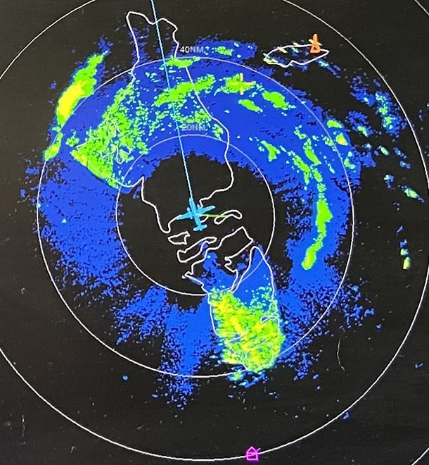
 Close-up of radar image of eye of Hurricane Isaias, as seen onboard NOAA hurricane hunter plane during its August 1, 2020 mission. Image courtesy of Ashley Lundry/NOAA
Editor’s note: This story was originally published by The Guardian. It appears here as part of the Climate Desk collaboration.
The National Oceanic and Atmospheric Administration (NOAA) has predicted an “extremely active” hurricane season in the United States in an already record-breaking year for storms. NOAA’s Climate Prediction Center said there could be up to 25 storms which have sustained winds of 39 miles per hour or greater. Storms which hit this threshold are named by the agency.
In a normal year, there are usually only two storms before August which are named.
This year, there have already been nine named storms, a record which makes 2020’s hurricane season one of the busiest on record in the United States. Gerry Bell, the lead seasonal hurricane forecaster at the Climate Prediction Center, said the combined intensity and duration of all storms during the season is predicted to be much higher than the threshold for an “extremely active” season.
“We’ve never forecast up to 25 storms,” Bell said in a press briefing. “So this is the first time.” The previous high was in 2005, when the agency predicted a maximum of 21 named storms.
Of the 25 possible named storms, NOAA estimates seven-to-11 could become hurricanes, which have winds of at least 74 mph. The agency also forecast that three-to-six storms could become major hurricanes, with winds of 111 mph or more. The hurricane season ends on November 30.
NOAA said there is an 85 percent chance it will be an above-active season, an increase from the May prediction. “This year, we expect more, stronger, and longer-lived storms than average,” Bell said in a statement. The NOAA forecast does not predict which of the hurricanes will make landfall, because those predictions rely mostly on short-term weather patterns.
The increase in predicted hurricanes is attributed to warmer-than-usual sea surface temperatures in the Atlantic Ocean and Caribbean Sea, combined with the wind conditions. There is also growing evidence that warming in the atmosphere and upper ocean, caused by human activity, is creating conditions more suitable for more destructive hurricanes.
Residents in areas more vulnerable to hurricanes have been encouraged to review their preparation plans for a possible storm, and to account for the effects of Covid-19 in that plan. This week, when Hurricane Isaias was heading towards South Carolina, health officials there advised people to add face masks and cleaning products to their preparations kits because of the virus. Officials also encouraged people who may need to evacuate to find hotels to go to, or family and friends to stay with, to avoid staying at a shelter, where socially distancing would be in place but is still an environment where the coronavirus could spread more easily.
Together, we make the world safer.
The Bulletin elevates expert voices above the noise. But as an independent nonprofit organization, our operations depend on the support of readers like you. Help us continue to deliver quality journalism that holds leaders accountable. Your support of our work at any level is important. In return, we promise our coverage will be understandable, influential, vigilant, solution-oriented, and fair-minded. Together we can make a difference.
Keywords: Climate Prediction Center, NOAA, climate change, climate crisis, global warming, hurricanes, severe weather, tropical storms
Topics: Climate Change


