How shifting ecoregions due to climate change complicates conservation
By Zach St. George | November 19, 2021
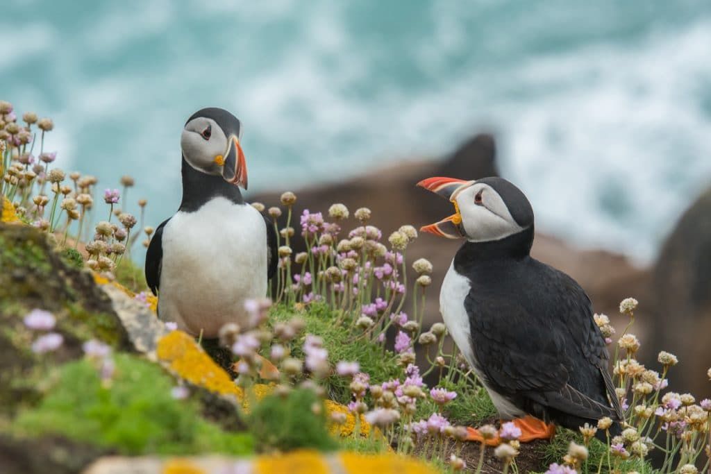 Photo by Wynand van Poortvliet/Unsplash
Editor’s note: This story was originally published by Yale Environment 360. It appears here as part of the Climate Desk collaboration.
Last month, parties to the Convention on Biological Diversity met virtually to set global conservation goals for the next decade. Although the 196 signatories to the treaty did not meet the goals they set a decade ago, they nevertheless are moving to expand on those goals, most notably with a proposal to place 30 percent of the earth’s continents and oceans in protected areas by 2030. This “30 by 30” plan has been the subject of fierce argument, with some critics calling it an environmentalist pipe dream and a neocolonialist land grab that, by restricting the activities allowed in newly protected areas, could negatively affect as many as 300 million people, including many of the world’s poorest.
But many scientists also are concerned about what is perhaps a deeper problem, for both new and existing protected areas: As the planet continues to warm, many protected areas will become less and less suited to the types of organisms and ecosystems they were created to protect. “The idea of national parks as a place where you could draw a line around an area and not do much of anything but protect it from external threats, that biodiversity would persist there—that’s no longer an accurate portrayal,” says independent ecologist Carlos Carroll.
The question is, what comes next? In recent years, scientists have suggested a number of new types of protected areas, from slowly changing places where species might find temporary refuge, to corridors where they might navigate a shifting climate and human-altered landscape. But these ideas remain relatively untested, and some scientists are skeptical that they will be any more effective in practice than protected areas created when conservationists still operated under the assumption of climatic stability.
Carroll is a co-author of a study published in September in Nature Communications that points to the scope of the challenge facing conservationists. Led by University of Montana ecologist Solomon Dobrowski, the study uses a method called “space-for-time,” in which one place in the world plays the ghost of another’s future. The simplest way to experience a warmer climate, after all, is to travel downslope or toward the equator.
The team began with a map of the current climate, broken down into four-square-kilometer cells. They then compared this map with a similar map built from a projection of the climate at 2 degrees Celsius (3.6 degrees Fahrenheit) warmer than its pre-industrial average—a degree of warming that models project we will reach by the middle of this century. Finally, they matched climatic cells on the future map with the cells on the current map that, within a 2,000-kilometer radius, bore the most closely matching climatic characteristics.
That sounds complicated, but a website the team built, “The Analog Atlas,” puts things neatly in human terms. When users type in their city, the map tells them what other city’s current climate will most resemble the future of the first. The map projects that the plus-2-degree-Celsius climate of New York City, for example, will closely resemble that of present-day Greensboro, North Carolina, 450 miles to the south. Milwaukee, Wisconsin will have a climate similar to that of Cumberland, Maryland. Las Vegas, Nevada will closely resemble Death Valley, California.
Dobrowski says that compared to other methods of peering into the world’s climatic future, space-for-time provides a fuller picture, offering hints not only of how a warmer climate will feel, but also what it may mean for the arrangement of living things. We might expect the plants and animals of future Las Vegas, that is, to more closely resemble the plants and animals of current Death Valley.
In the Nature Communications paper, the team overlaid their space-for-time map on a widely used map of the world’s roughly 850 “ecoregions,” or “geographically and ecologically defined areas that contain distinct assemblages of plants and animals.” Other researchers have proposed using ecoregions to help prioritize which parts of the world to protect, but the study suggests that ecoregions may be an elusive target.
By the middle of the century, the team projected, more than half of the world’s terrestrial surface will have the climatic characteristics of a different ecoregion than at present. What is currently a closed canopy forest in one place might be an open woodland, for instance; a grassland in another place might become a desert. For humans and other species alike, the shifting climate will make some places more comfortable, others less comfortable. “Can we build a protected area network that has more resilience to those changes,” Dobrowski asks, “rather than what we’re currently doing, which is stick our head in the sand and ignore it?”
For decades, scientists have worried that many species would not be able to keep up with the current rate of climatic change, now occurring faster than in all but the most catastrophic periods of change in the past. This has led many scientists to seek places where change is likely to happen more slowly than in immediately surrounding areas. They call these places “refugia,” a term originally used in paleobotany, where it referred to places where species weathered past periods of climate change, especially the glaciations of the Pleistocene.
Looking back across the fossil record, it’s possible to see that refugia were indeed places of refuge, and not simply dead ends. That isn’t possible in the present day, which means that modern climate refugia aren’t intended to completely resist change, says U.S. Geological Survey research ecologist Toni Lyn Morelli, who has written extensively about climate refugia. “It’s more realistic to think about it as a slow lane,” she says. “The climate is changing less quickly there, so it potentially gives an opportunity for a species to adapt, or just have enough time to establish elsewhere.”
For every species and from every threat, there are potential refugia. In recent years researchers have projected that Quebec might be a refugium for the North American boreal species, as the vast forest contracts under the warmer and drier climate projected to occur in the future. They have pointed to places where cooler stretches of water might allow salmon and trout to persist in Massachusetts, Oregon, and the Northern Rockies. They have located small, scattered refugia in the conifer forests of Oregon and California, where topographical or hydrological variation might allow patches of forest to escape the effects of fire, insect outbreaks, and drought. They have examined where Patagonian glaciers might linger the longest, and how best to create and maintain refugia for Idaho’s Cassia crossbills, a rare finch.
The burgeoning scientific interest in conservation refugia reflects a recognition “that all systems have mosaics and heterogeneity,” says Oregon State University pyrogeographer Meg Krawchuk. As the climate changes, she says, “All these nodes are important in allowing resilience and adaptiveness of the system.”
As some scientists focus their attention on places where species might be able to linger, others have tried to find places where they will be most able to move from one habitat to another. Even species physically able to track the rate of climate change will face a landscape greatly altered by humans, pocked with cities and towns, scarred with roads, and covered with vast farms where forests once stood. Ecologist Jodi Hilty says her scientific interest in wildlife corridors began first in Africa, then in Sonoma, California, where she studied how animals moved up and down the wooded areas alongside rivers and creeks. Wildlife corridors can be as small as a shaded riparian zone, a hedgerow, or a footpath over a highway. But scientists hope that in the future, many wildlife corridors will be much bigger than that.
Hilty is now the president of the Yellowstone to Yukon Conservation Initiative, a project that aims to link protected areas along the Northern Rockies. It was inspired by the travels of a wolf named Pluie. In 1991, researchers in Alberta fitted the wolf with a GPS tracking device and were stunned when she circled an area encompassing more than 40,000 square miles before someone shot her in 1993, just outside the boundaries of Kootenay National Park. “At that time it was revolutionary to have GPS collars and realize that a lot of the animals we thought were park animals were not just park animals, and that they needed room to roam,” Hilty says.
Today, the corridor stretches for hundreds of miles along the Rocky Mountains, encompasses more than 500,000 square miles, and involves hundreds of partners, including local, regional, federal, and tribal governments, as well as private businesses and nonprofits. It includes many known and projected refugia and spans a wide elevational and latitudinal range. The authors of several recent papers have pointed to the project as a model of what climate-ready protected area networks might look like—a corridor created to allow individual animals to migrate is well-suited to allowing entire species to migrate, too.
The project has inspired imitators around the world, Hilty says, including the Great Eastern Ranges corridor in Australia and the Baja-to-Bering Marine Initiative, a marine conservation corridor that conservationists hope to establish along North America’s west coast. Currently, less than half of the world’s protected areas are connected to one another. In a 2020 study, though, a group of researchers estimated that mile-and-a-half-wide corridors connecting all of the world’s protected areas would require just four percent of the world’s terrestrial surface—a small fraction of what conservationists hope to protect.
There are risks in attempting to predict the locations of refugia and corridors that will be useful in the future, as retired Forest Service paleoecologist Connie Millar points out. Millar was an early proponent of bringing the refugia concept into a modern conservation context and remains broadly in favor of the scientific effort to seek out future refugia. She worries, though, that in creating supposedly climate-resilient conservation corridors and refugia, conservationists could fall into a familiar trap, imagining that those areas, once designated, will continue to function in perpetuity.
There is also the risk of simply misreading where species will need to go, she says. The fossil record shows that during past periods of climate change, species ranges and abundances changed wildly, often forming ecosystems with no modern equivalent. Trying to predict what species, ecosystems, or even entire ecoregions will do as the climate changes again is difficult, even without accounting for the effects and scope of human disturbance. “We think we have the best scientific information,” she says. “But basically we’re playing God, and we make mistakes.”
In light of these challenges, some scientists have suggested an approach to conservation that starts not with living things, but with their physical settings. Variations of elevation, latitude, slope, aspect, soil type, and geology are all drivers of evolution, and are responsible for much of the current arrangement of life on Earth. Preserving a wide array of physical settings will conserve not only biodiversity as it currently exists, but as it may exist in the future, say proponents of the approach, which they call “conserving nature’s stage,” extending an old ecological metaphor in which physical settings are the stage, species the actors, and their interactions the play.
“What we seek to conserve for all species,” wrote a group of researchers led by University of Washington ecologist Joshua Lawler in a 2015 paper, “are interactions with other organisms and their environments: a stage with many settings and many actors playing many parts.”
Eric Dinerstein, a scientist at the Washington DC-based conservation nonprofit Resolve, says the biggest problem with existing protected areas, though, isn’t kind, but quantity. Most of the riddles of which species will be where, when, under a warmer climate would work themselves out if protected areas were larger and better connected, he says. He is the lead author of two recent papers that argue in favor of the 30 by 30 plan, and suggest an additional 20 percent of the earth’s surface should be protected as “climate stabilization areas.”
In the papers, Dinerstein and his colleagues propose prioritizing new protected areas based on ecoregions, refugia, corridors, topographical and physical diversity, and other measures. But the areas in most immediate need of protection, they argue, comprise just 3 percent of the earth’s surface, and are composed of the places where species of exceptional rarity are clustered. While a changing climate may ultimately pose an existential threat to many species, Dinerstein says, many more are now threatened by old and familiar proximate causes—habitat destruction, invasive species, and poaching.
“Of course we want to design reserve networks that are resilient to climate change,” he says, “but we can’t lose sight of other threats.”
Together, we make the world safer.
The Bulletin elevates expert voices above the noise. But as an independent nonprofit organization, our operations depend on the support of readers like you. Help us continue to deliver quality journalism that holds leaders accountable. Your support of our work at any level is important. In return, we promise our coverage will be understandable, influential, vigilant, solution-oriented, and fair-minded. Together we can make a difference.
Keywords: climate change, climate crisis, conservation, ecoregions, refugia, wildlife, wildlife corridors
Topics: Climate Change


