Hurricane Helene isn’t an outlier. It’s a harbinger of the future.
By John Morales | September 30, 2024
 A National Oceanic and Atmospheric Administration satellite captured Hurricane Helene making landfall near Perry, Florida, just east of the Aucilla River's mouth on Sept. 26, 2024, at 11:10 p.m. EDT. With winds reaching 140 mph and storm surges estimated at as high as 15 feet, the Category 4 storm was among the most powerful to strike the United States. Photo credit: National Environmental Satellite, Data, and Information Service.
Something’s shifted. And it’s not just the climate.
Even before being named a tropical storm, I knew that what would become Mean Helene was set on a mission to be yet another multibillion-dollar disaster. I knew that it would undergo rapid intensification and become a catastrophic hurricane. And I knew that a calamitous rainfall event would unfold in the Southeast many hours after landfall.
So, I did what I’ve done during my entire 40 year career—I tried to warn people. Except that the warning was not well received by everyone. A person accused me of being a “climate militant,” a suggestion that I’m embellishing extreme weather threats to drive an agenda. Another simply said that my predictions were “an exaggeration.”
But it wasn’t an exaggeration.
The storm surge from Helene was widespread and up to 15 feet (4.5 meters) deep. The windstorm sliced through the Southeast with gusts up to 100 miles per hour (160 km/hr). And the rains were, as I predicted, “biblical.”
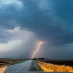
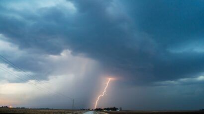
Helene became a major hurricane on September 26th amid a rapid intensification (RI) cycle in which it attained 55 mph (~90 km/hr) greater windspeeds in a span of 24-hours—just short of the “extreme” RI threshold of 58 mph (~95 km/hr) in 24 hours. It was the second time since it formed that maximum sustained windspeeds had increased by at least 35 miles per hour (~55 km/hr) in a day.
As a result, Helene went from an 80-mph (130 km/hr) low-end Category 1 hurricane one day to a 140 mph (225 km/hr) Category 4 cyclone the next. According to the Saffir-Simpson Hurricane Wind Scale, Category 1 hurricane damage would be expected to be “minimal,” while Category 4 hurricane damage would be “devastating.”
Helene was the second major hurricane (Cat 3 or higher) of the 2024 season. Record-setting Hurricane Beryl preceded it as the earliest-forming Category 5 hurricane in the Atlantic basin’s history. Beryl became a major hurricane in the month of June east of the Lesser Antilles, the first time that’s ever happened during the first month of hurricane season since recordkeeping began in 1851.
While Beryl weakened before reaching the United States as a Category 1 hurricane, Helene intensified into a major hurricane and continued strengthening right up to landfall. That now puts 2020-2024 into the record books, tying the mark for the longest consecutive number of years (five) in which a major hurricane has made landfall in the United States.
Hurricane Helene’s wind field was about as large as they come. The diameter of sustained tropical storm force winds reached over 450 miles (725 kilometers). Based on historical statistics of tropical cyclone size, that put Helene in the 90th percentile. Miami, never closer than 300 miles (485 km) from Helene’s center, experienced a wind gust of 72 mph (116 km/hr). Hurricane force winds also extended out an unusually far distance of 60 miles (97 km) from the eye.
The large wind field was a big reason why the National Weather Service forecasted an “unsurvivable” storm surge. Storm-force winds roared from south-southwest to north-northeast across the entire eastern Gulf of Mexico. This long wind fetch drove water towards Florida.
The concave shape of the coastline between Apalachicola and Clearwater helped “collect” all that Gulf water, which was driven even higher because of bathymetry—the depth and shape of the seafloor. Waters are shallow in that region because the continental shelf extends out from Florida far into the Gulf. That means that there isn’t much room to “store” the water being driven towards the coast by the hurricane.
The resulting surge was immense. Preliminary post-landfall modeling of storm surge from Helene indicated areas within the Big Bend region of the state near Keaton Beach, Steinhatchee and Horseshoe Beach had water levels reach more than 15 feet above ground level. Along the west coast of the Florida peninsula, Cedar Key had a record surge of 9 feet, while Tampa Bay experienced a modern-day record surge of approximately 7 feet.
The depth of the saltwater inundation was extremely well forecast by the National Hurricane Center. Yet, in Florida, dead bodies were found in evacuated coastal areas where some had retreated to their attics to avoid the rising storm surge.
If that wasn’t enough, damaging winds penetrated well inland, thanks in part to Helene’s extreme strength, but also because the storm’s speed of motion was accelerating as it made landfall, and its wind field was so huge that it took quite some time to wind down. Windstorm damage extended far inland beyond Florida to Georgia, South Carolina, and North Carolina. A 100-mph (160 km/hr) gust was recorded in Alma, Georgia. Mount Mitchell North Carolina, the highest peak east of the Mississippi, had a gust to 106 mph (~170 km/hr) from Helene.
And then came the rain.
Preliminary storm-total rainfall measured on the ground included nearly 31 inches (782 millimeters) in Yancey County, northeast of Asheville, North Carolina. Radar estimated totals in areas where there were no rain gauges exceeded 40 inches (1,000 mm) just over the state line in South Carolina’s Greenville County.
Approximately half of Chimney Rock, North Carolina, has been reduced to debris that has flowed into Lake Lure. The regions of Western North Carolina and Eastern Tennessee are going to require extensive assistance in the following weeks and possibly months for recovery.… pic.twitter.com/ciR59qRxRY
— Live Storm Chasers (@LiveStormChaser) September 29, 2024
A Predecessor Rain Event caused by a stalled weather front had hit that very same region just days prior to Helene’s impacts, saturating the ground on the heels of what had been a wetter-than-normal summer. The flooding and landslide disaster that Helene’s rainfall caused was facilitated by topography, as runoff rushed into the creeks and rivers that flow down from the Appalachian Mountains.
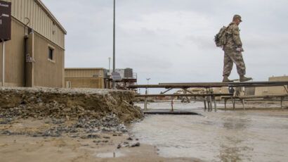
Helene’s extreme floods have resulted in apocalyptic scenes. Some small towns were mostly leveled. Others are cut off from surrounding civilization, with no way in or out except by air. It is a humanitarian catastrophe that is still unfolding.
Beyond the short-term suffering from its immediate victims, long term implications of Helene’s hecatomb include more pressure on the US Federal Emergency Management Agency (FEMA) and state-level relief agencies, more fuel for a burgeoning insurance crisis, and more reasons to think twice about building or rebuilding in harm’s way in a century that looks nothing like the past. Because the hurricanes of the early 21st century are not like the ones of the 20th century.
Warming oceans are fueling stronger tropical cyclones—the costliest weather disasters in the United States. Helene’s intensity took off while passing over waters that were over 3 degrees Fahrenheit hotter than historical averages, a condition made 600 times more likely by climate change, according to Climate Central’s CSI Ocean index. Since 2017, eight Category 4 and 5 hurricanes have struck U.S. soil—as many Cat 4 & 5 landfalls as occurred in the previous 57 years.
This concerning recent trend fits overall tendencies in the Atlantic. Observations show an increase in tropical cyclone intensification rates in the Atlantic basin from 1982-2009. The number of storms that quickly intensified from Category 1 (or weaker) into a major hurricane more than doubled in 2001-2020 compared to 1971-1990.
Globally, the proportion of tropical cyclones that reach very intense (Category 4 and 5) levels is projected to increase, too. Higher tropical storm and hurricane rainfall rates, like those seen in the Appalachians, are expected to continue in a warming planet. And, in places like Florida, sea level rise is accelerating at such a dramatic pace that today’s storm surges can reach 8 inches (20 centimeters) higher than when Hurricane Andrew struck south of Miami a little over 30 years ago.
For decades I had felt in control. Not in control of the weather, of course. But in control of the message that, if my audience was prepared and well informed, I could confidently guide them through any weather threat, and we’d all make it through safely. Today as a result of so many compounding climate-driven factors, the warming world has forcibly shifted my manner from calm concern to agitated dismay.
Now I look at storms differently. And I communicate differently. I don’t need to be told “you’ve changed” to know that I’m not the same. Perhaps those who have known me as the just-the-facts non-alarmist meteorologist can’t get used to the new me. That’s why they bicker and accuse me over overhyping emerging weather threats.
But no one can hide from the truth. Extreme weather events, including hurricanes, are becoming more extreme. I must communicate the growing threats from the climate crisis come hell or high water—pun intended.
Together, we make the world safer.
The Bulletin elevates expert voices above the noise. But as an independent nonprofit organization, our operations depend on the support of readers like you. Help us continue to deliver quality journalism that holds leaders accountable. Your support of our work at any level is important. In return, we promise our coverage will be understandable, influential, vigilant, solution-oriented, and fair-minded. Together we can make a difference.
Keywords: Hurricane Helene, climate change, climate militant, rainfall, storm surge
Topics: Analysis, Climate Change

John Morales
John Morales is an atmospheric and environmental scientist and an honorary member of the American Meteorological Society. He is the hurricane... Read More


Thank you Mr. Morales. I have been following you since Hurricane Maria in 2017. Thank you for all you do.
Thank you John Morales. I grew up watching you, and still remember the 2006 season. I remember your calm concern during those times, guiding us, trying to take care of everyone. Now, having moved to the mid-west, I consider myself somewhat of a climate migrant, moving up north seeking some semblance of refuge.